Since 2001 I’ve made a trip to Ashland, Ore. at least once a year, usually more often. And somewhere over the years I became aware of a race that seemed challenging, to say the least: the Mt. Ashland Hillclimb Run.
The race starts in downtown Ashland where Lithia Park begins (elevation 1900′), and proceeds almost continuously uphill to finish at the summit of Mt. Ashland (elevation 7533′) for a rise of more than 5600′ over a distance of about 13.3 miles.
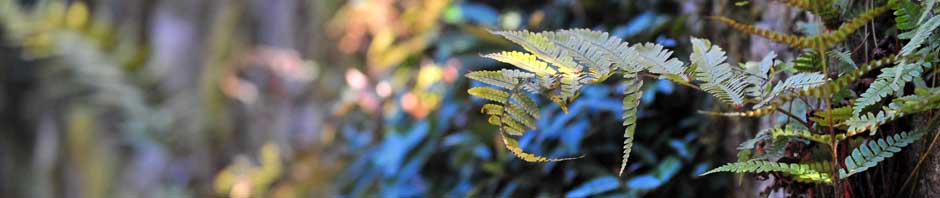
THE GOAL: MT. ASHLAND AS SEEN FROM DOWNTOWN ASHLAND
At some point this year, mere knowledge of the event turned into a decision to run it, so I signed up soon after registration opened in May and shortly after I had run the Eugene Marathon. The field is limited to about 250, and it fills up quickly so I wanted to be sure I had a spot.
Then for the next three months I hemmed and hawed about the event saying things like “if I do it” and “if I finish”. For a race that I care about, I usually have a public goal and sometimes a secret and more ambitious goal, but for this one both publicly and privately all I cared about was showing up at the starting line and dragging myself up a mile vertically and living to tell about it. I told my partner Keith, who would pick me up at the top of the mountain, to expect a finish time of at least 3.5 hours.
The other thing about the lead-up to the run was that I didn’t really have a clue about how to train for it and consequently I didn’t. For those familiar with Chico, I did three 15-mile runs starting from One Mile to a point along the rutted road in upper Bidwell Park and back. Plenty of uphill, but of course on an out-and-back run what goes up, must come down. I never had a long training run that was just a continuous uphill grind.
So I arrived at the starting line pretty sure I was unprepared for whatever was about to follow. but curiously not especially apprehensive. Que ser, que ser.
WAITING FOR THE RACE TO BEGIN
My strategy was simple: keep putting one foot in front of the other, don’t race, don’t compete with anything other than gravity and anyone other than myself.
The race began at 7:30 a.m. sharp at the beginning of Lithia Park in downtown Ashland just a few yards away from the plaza. Up we went through the park, a dirt road, back briefly on city streets, and then more dirt roads on U.S. Forest Service land. Maybe 3 miles into it we passed a locked gate so the chance of seeing any vehicular traffic ended right then and there. (All distances are guesswork because the course did not have mile markers along the way.)
STARTING LINE OF THE 2010 MT. ASHLAND HILLCLIMB RUN
The first five or so miles were familiar to me because Keith and I on our many visits to Ashland have hiked quite a bit above the town. But the known soon became the unknown. Not that the changes were dramatic. With one notable exception, the course simply goes up and up, and is nearly all under a full or partial canopy of trees.
The event provides four well-provisioned aid stations (the usual liquids but also bananas, oranges, salty stuff, etc.) spaced roughly every three miles. The locations seemed to be just where I needed them most.
The third aid station at a location called Bull Gap comes after the only significant stretch in the entire race that is level or downhill. I don’t wear a GPS watch so I can’t say exactly how far it was, but my estimate is that it was about 1 to 1.5 miles in length.
But after the Bull Gap aid station the fun begins.
Immediately after the aid station the road changes from vehicularly accessible to rutted single-track. Along this part of the course I made a number of what I call footfaults (stumbles) as I was getting tired and not lifting my feet high enough over the uneven surface. I never actually fell but I felt klutzy. Also I chose to powerwalk instead of run three times when terrain and fatigue led me to conclude that it would be as fast or faster than running, and much less tiring. The powerwalking portions probably totaled no more than three-quarters of a mile, and definitely were the smart thing to do.
But just when I was starting to think that this was fun I could do without, a large clearing appeared ahead. It was the Mt. Ashland ski lodge – yahoo!
It’s the location of the last aid station before the final push to the summit, and where friends and spectators gather because access to the summit itself is restricted.
Surprisingly, when I reached the lodge it was only 2 hours and 35 minutes into it. Keith and our friends Phileo and Sue from Seattle, with whom we often rendezvous in Ashland, were nowhere in sight at the ski lodge, but it was because I’d offered such low expectations for my performance.
One of the things I liked about the course is that periodically the summit of Mt. Ashland comes into view. At first it appears that you are making no progress at all, but eventually it does seem that your work has brought some result. When you get to the last aid station at the ski lodge, the summit, in fact, seems very close but closing that last gap is definitely the toughest part of the event.
But to inspire a runner before that last ascent is the view backwards from the ski lodge.
It’s the only point during the race that I could see where I’d come from and the view is breathtaking. It was hard to believe that I’d run from Ashland faraway and down in the valley below. If I’d come that far surely I could do the rest. A nice thought. Naive, but nice.
I made a quick stop for sustenance, took a few running steps away from the lodge in the direction of the summit, but soon I ceased all running for the duration of my quest.
It’s only a half-mile from the ski lodge up to the summit but to say it was grueling gives grueling a bad name. Except for the studliest, it begins with walking and slows down from there. The absolutely final push may only be a few hundred yards in distance but it’s a tortuously slow scramble at a very steep angle on rocks, scree and scrub. It’s a finish line many folks lunge or crawl through as opposed to run or even walk.
In years gone by, this last stretch wasn’t even marked; it was just a free-for-all, get to the summit however the heck you could. Thankfully this year it was marked where it really needed to be marked. On that very last scree-scramble it’s painfully clear where you need to go but it’s just very difficult to get there.
That last half-mile took me close to a half-hour to complete. I stumbled across the finish line at 3:02:20. My slowest half marathon by far but in some ways one of the most satisfying. But boy, was I glad it was over!
I ran part of the way and talked a little bit with a fellow my age named Ben from Corvallis, Ore. Ben ran the event in ’09, and this year finished almost the same time I did. Instead of taking the pick-up truck shuttle that brought runners the two miles back down to the ski lodge area where the finish party was, we just walked figuring it would help loosen up our legs. Keith and Phileo ran into us not long after we embarked, as they were coming up to the summit in a returning pick-up truck, so it was now four of us on foot heading to the lodge.
Where the beer was.
Ashland’s Standing Stone Brewing Co. is a long-time sponsor of the event and besides generously putting a $10 gift certificate in every runner’s goody bag, stations a couple of kegs up at the ski lodge to reward runners who wish to celebrate. I did and so did Ben. Later that night my Gang of Four met up with Ben’s Gang of Two (he and his wife, Melody) at Standing Stone to continue celebrating.
BEN AND GREG POST-RUN AND MID-BEER
Do I want to run this race again? Yes. Next year for sure.
Do I want to do better? Yes, I have the very modest goal to come in under 3 hours. I need to figure out a way where I live to engineer some long, uphill runs. (Or maybe I should just move to Ashland – what a terrible thought.)
A few other notes about this year’s event.
The men’s record that had stood since 1986 was broken this year by just 10 seconds. Max King, 30, of Bend, Ore. completed the course in 1:41:50. That is smoking.
The fastest woman this year, Stephanie Howe, 26, also of Bend, finished in 2:12:07. (The female course record is 2:08:40 set in 2008 by Evelyn Dong.)
Of the 259 registrants for the event, 35 DNSed (did not start/no showed) and 40 DNFed (did not finish, mostly at the ski lodge). 184 completed it. (Here are complete results)
I was reasonably pleased with my effort. Overall I finished 77th out of 184. However in my division, Men 50-59, I was right in the middle finishing eighth out of sixteen. The fastest came in at 2:24:57 (Joe Griffin of Central Point, Ore.) and four other guys came in under 3 hours. Congratulations, fellows!
The event is very well organized.
On-line results were provided quickly, as well as a cleverly written on-line survey soliciting feedback about the event. The race organizers communicated well with registered runners leading up to the event, and the person who writes the stuff makes it both entertaining (and sassy) as well as information-laden.
To wrap up the story: this is clearly not an event for everyone but if you train reasonably well, or at least (like me) have a fairly strong base, you can probably do it. Unless you’re Max King or Stephanie Howe, keep a realistic goal of simply finishing and you might even do better than you expect. And register early because the Hillclimb Run is popular and fills up quickly. Next year’s race takes place on Saturday, 6 August 2011. Registration will open around 15 May.